
Sources for Walla Walla Neighbors
Looking up Walla Walla neighbors begins with the block, not a name list. City GIS can locate an address and identify mapped features. County PropertyAccess adds parcel, sale, tax, and appraisal context. eTRAKiT reports land-use, building, restriction, legal-description, and inspection details. EagleWeb holds recorded instruments. Voter data is governed by state access rules, and historical directories offer a dated view. These sources overlap, but none is a live household roster.
| Source | What It Shows About a Block | Access |
|---|---|---|
| City interactive GIS maps | Address, street, parcel, ward, project, and other selected layers | Public web maps; layer dates vary |
| County PropertyAccess | Parcel details, owner result fields, sales, tax area, map, and legal-description clues | Public online search; assessor phone fallback |
| County eTRAKiT | Parcel, owner, land-use, building, restrictions, legal description, and inspections tabs | Public online parcel search |
| Washington voter file | Public registration fields subject to statutory limits and protected records | Secretary of State request process |
| Historic directories | Dated residents or subscribers by address where a street section exists | Whitman Archives and State Library holdings |
An assessor owner field identifies the tax-roll owner at the database date. The mailing address may differ from the property's physical, or situs, address. A business or trust can hold title, and the people living there may not appear. Confirm every nearby lot separately, and avoid turning one field into a claim about a household.
Map Walla Walla Neighbors Nearby
The city's interactive GIS collection documents Search and Identify tools. Search can locate an address, parcel number, street, or project. Identify returns attributes from the active map layer. The county PropertyAccess Map Search is the better bridge to parcel details. No official capture confirmed a one-click buffer or complete adjacent-owner list, so walk the map parcel by parcel.
- Locate the starting address, then note the map title, active layers, and access date.
- Select the parcels that touch its sides and rear. Include lots directly across the street only when the research question calls for them.
- Open each parcel in PropertyAccess and save its Property ID, parcel number, property address, tax area, sale date, and details link.
- Check the legal description and current map shape before assuming two similar street numbers are adjacent.
- Use eTRAKiT or EagleWeb only for the parcel-specific building or deed question that remains.
GIS data comes with an accuracy disclaimer. Parcel lines on a public viewer help organize research but are not a survey. A whole named-street search has a different scope and is covered in the Walla Walla street directory.
Read Walla Walla Neighbor Records
Walla Walla County PropertyAccess accepts Property ID, a 16-digit geo parcel number, street number, partial street name, doing-business-as text, sale dates, and several legal-geography fields. The 16-digit parcel format is grouped 6-6-4: township, range, and section; map coordinates; then an added parcel sequence. Official exports show an Owner Name result column, although the current static search page did not expose an owner-name input.
| Field | How it helps with the block |
|---|---|
| Property address | Places the parcel at its physical street location. |
| Owner name | Reports the assessment owner, not necessarily an occupant. |
| Tax area | Shows taxing geography, which is not the same as a neighborhood. |
| Sale date | Dates a transfer clue that should be checked in recorded documents. |
| Details and map | Connect the database row back to parcel context. |
If the desired search control is unclear, call the Assessor at 509-524-2560. A static portal capture cannot establish a live resident, and prior-year values on the site are described as informational.
Three Walla Walla Neighbor Questions
Walla Walla County keeps three systems that are easy to confuse. PropertyAccess answers parcel, appraisal, tax, sale, and map questions. EagleWeb answers questions about recorded instruments such as deeds, liens, plats, and easements. The eTRAKiT parcel search supplies land-use, building, legal-description, restriction, and inspection tabs. A result in one system does not replace evidence in another.
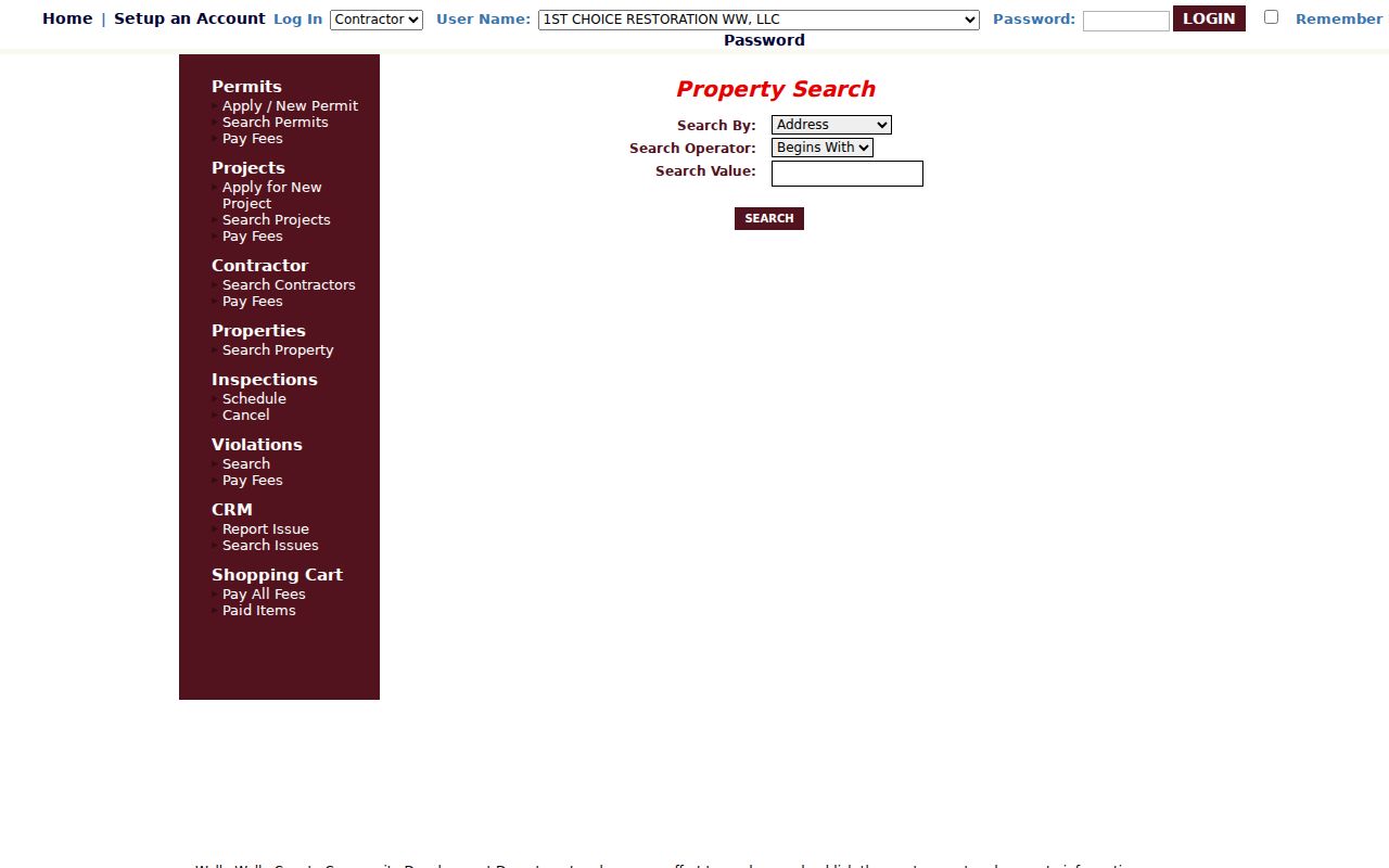
The captured search screen shows why a parcel must be selected before its detail tabs can add context about the surrounding block.
| Question | Official starting point | Limit |
|---|---|---|
| Which parcel touches this one? | City GIS or PropertyAccess map | Public map is not a boundary survey |
| Who holds the assessed parcel? | PropertyAccess result | Ownership does not prove residence |
| What was recorded against it? | EagleWeb | Online index begins in 1951 |
| What building activity is listed? | eTRAKiT | Portal disclaimer applies |
This local split is useful. It prevents a deed index from being read as a current appraisal record and stops an inspection note from being treated as personal information about Walla Walla neighbors.
Place Walla Walla Neighbors by Lot
Street numbers can be mistyped, changed, or shared by units. EagleWeb can search subdivision, block, and lot, including a lot range such as 12:30. A legal description ties a recorded instrument to land more reliably than a name alone. Once a parcel result supplies the subdivision and lot clues, use them to test whether nearby parcels share an older plat or related instrument.
Shared subdivision history does not mean the owners are related, and adjacent parcels can have very different deed chains. Record the reception number and date for each instrument. EagleWeb's online index begins January 1, 1951; earlier records require help from the Auditor or archives.
- Parcel
- A mapped and assessed unit of land.
- Plat
- A recorded map dividing land into lots, blocks, streets, or easements.
- Situs address
- The physical property address, distinct from the owner's mailing address.
- Tax area
- A taxing-jurisdiction code, not a neighborhood name.
Washington Voter Rules for Neighbors
VoteWA/MyVote is a personal registration check using the voter's own identifying details. Broader voter-file access follows the Secretary of State request process. RCW 29A.08.710 makes specified fields public, including name, address, political jurisdiction, gender, year of birth, voting record, registration date, and registration number, subject to protections. Washington does not register voters by party, and voting history never reveals ballot choices.
State law restricts use and solicitation from voter data. Address Confidentiality Program records and other protected voter records must remain shielded. Never use parcel, directory, or map clues to reverse a substitute address. A voter entry is dated registration evidence, not proof that every adult at a Walla Walla address is listed or that a person is present today.
Walla Walla Neighbor Contacts
The City of Walla Walla runs a Neighborhood Engagement Program with block projects and neighborhood resources, but the research did not locate an authoritative current inventory of named associations or member directories. Ward boundaries, ZIP codes, subdivisions, and informal neighborhood names are different geographies. Do not invent an association or assign a block to one from an undated third-party list.
Neighborhood Engagement
Use the city's official program page for current contacts, eligible projects, and neighborhood resources.
City GIS Division
15 N 3rd Avenue
509-524-4465
Ask which official layer best defines the block or ward.
City Clerk
15 N 3rd Avenue
509-527-4424
Request city records when no public index answers the question.
Community rosters, congregational lists, and block-watch contacts may be private or limited to participants. Ask the organization directly and respect its access rules. Civic contact is a better use of the community layer than trying to build a private household list.
Find Past Walla Walla Neighbors
Whitman Archives holds Walla Walla city directories and newspaper microfilm. The State Library lists city directories from 1900 through 2000 with gaps and telephone directories through 2011 with gaps. Ask whether the chosen volume has a street section or reverse arrangement before visiting. No official inventory confirmed a Walla Walla-specific criss-cross run.
For each period entry, save the volume title, year, page, exact address, and abbreviation key. Compare the street section, if present, with alphabetical entries and the nearest census year. Historic neighbors reflect one publication or enumeration date. They should not be projected onto the present block.
Protect Your Walla Walla Neighbors
Public systems do not reveal every person on a block. Parcel records emphasize land and assessed owners. Voter files omit people who are not registered and shield protected records. Utility, delivery, and many membership records are not public resident directories. Court, police, and vital records also contain restricted or redacted material.
Official rolls are best for a defined record question with a known date and custodian. Commercial neighbor tools often merge stale or mismatched data without showing the source date. Prefer the official parcel, deed, map, and voter routes, and label what each result can actually establish.
Lawful use. Research Walla Walla neighbors for civic contact, history, or personal safety. Never watch, harass, or intimidate anyone.